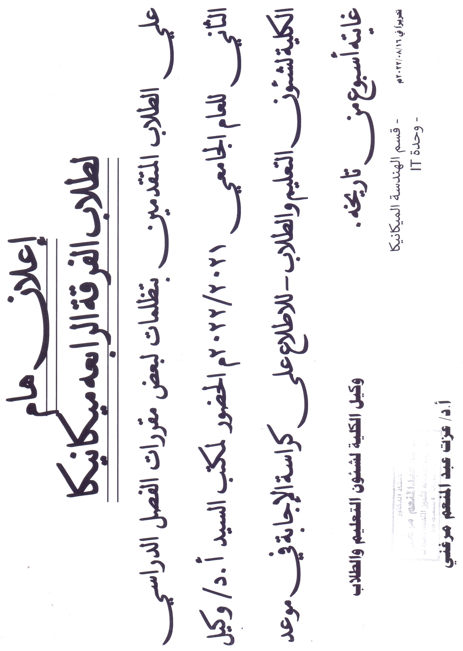
Important announcement for students of the fourth year, Department of Mechanical Engineering Read more about Important announcement for students of the fourth year, Department of Mechanical Engineering 16 August 2022
Engineering Education Development Center Read more about Engineering Education Development Center 21 August 2022
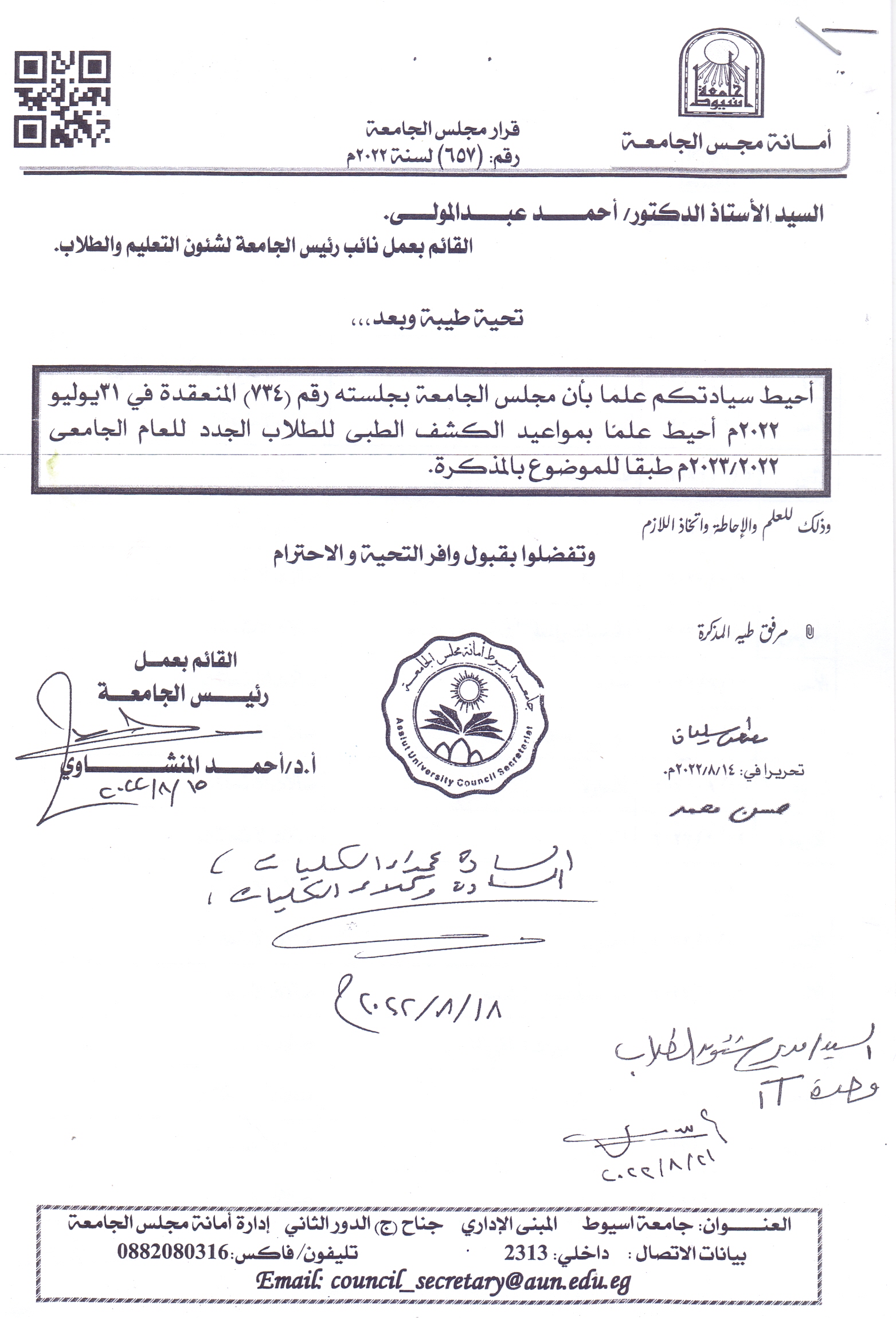
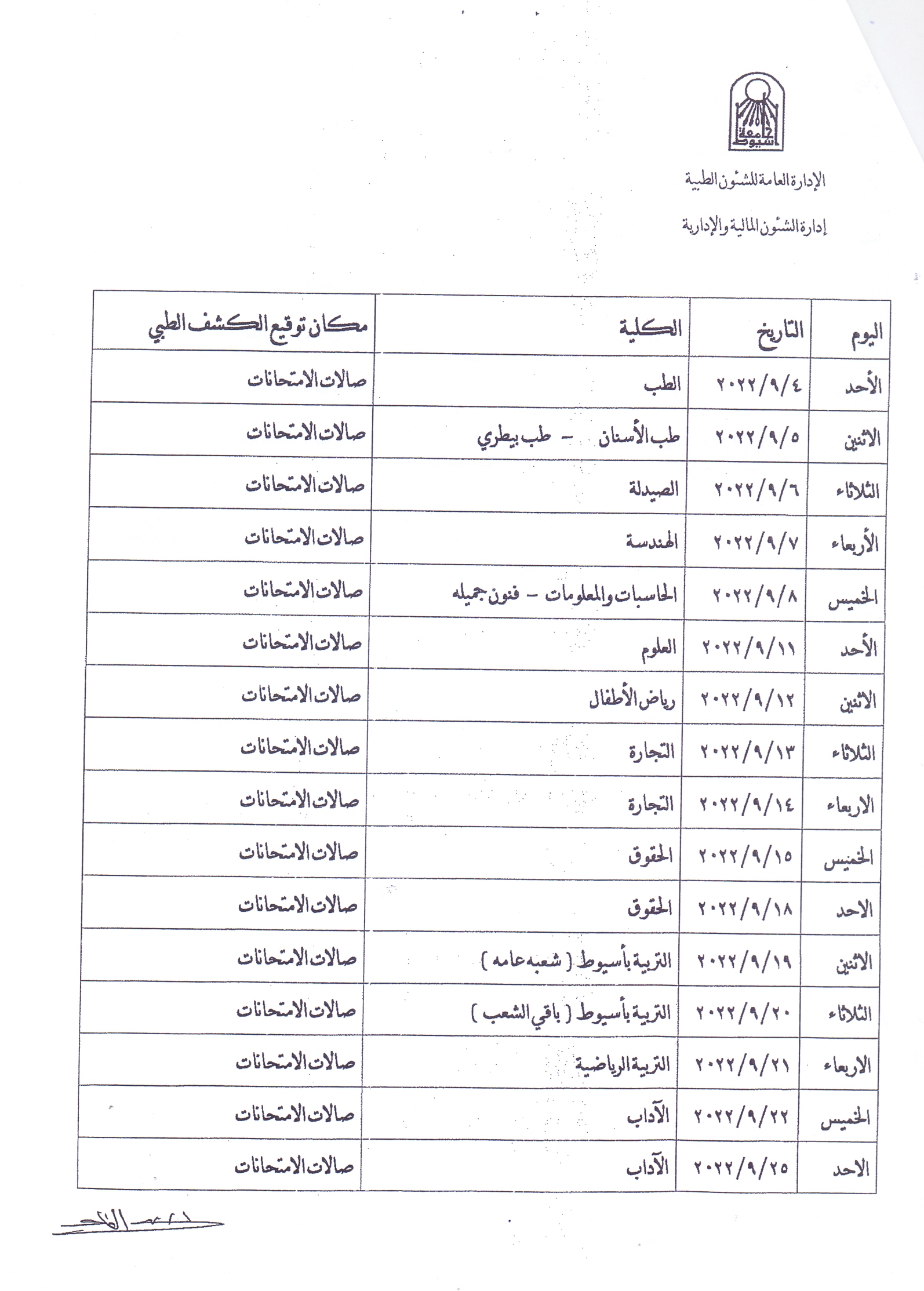
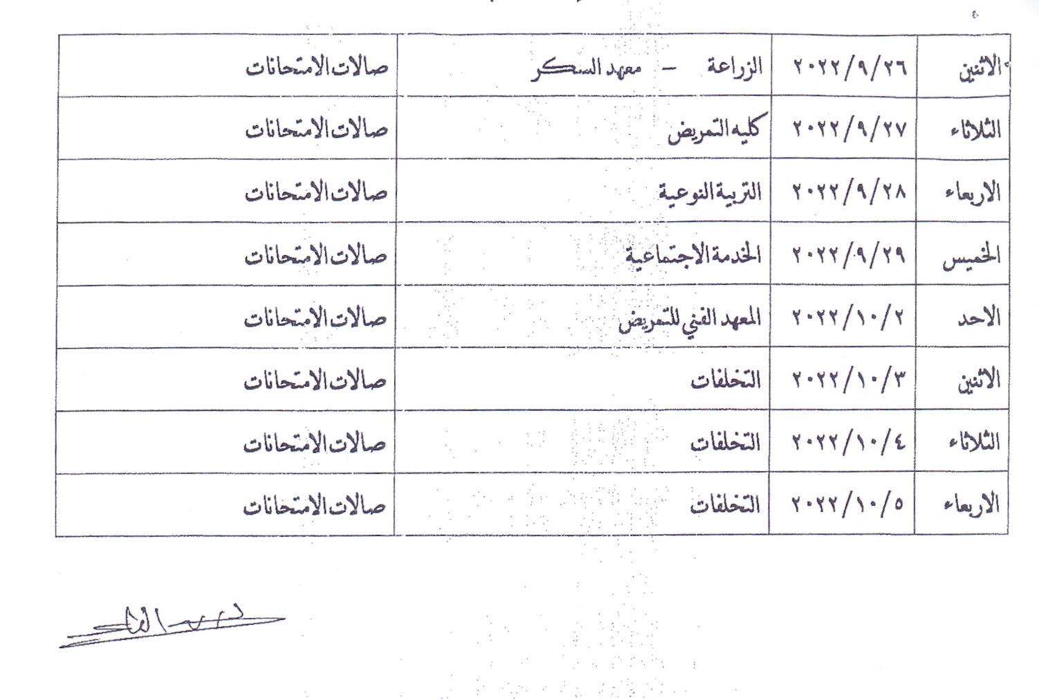
Medical examination dates for new students for the academic year 2022/2023 Read more about Medical examination dates for new students for the academic year 2022/2023 23 August 2022
Soon Read more about Soon Soon Holding a Job Fair at the College of Engineering And a meeting with major companies in various specialties 5 September 2022
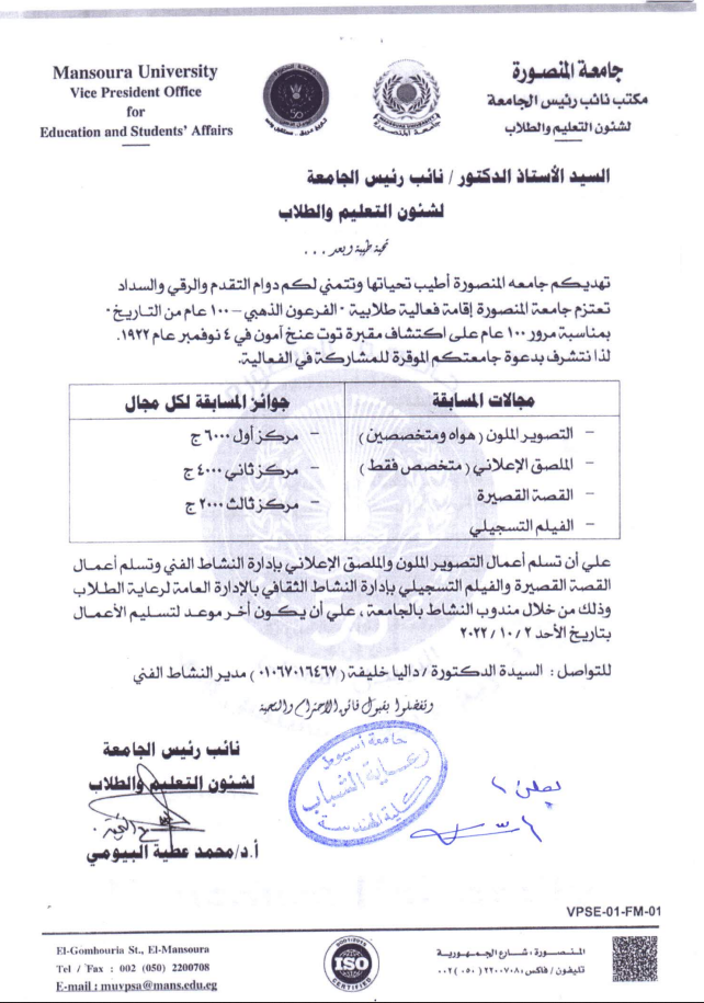
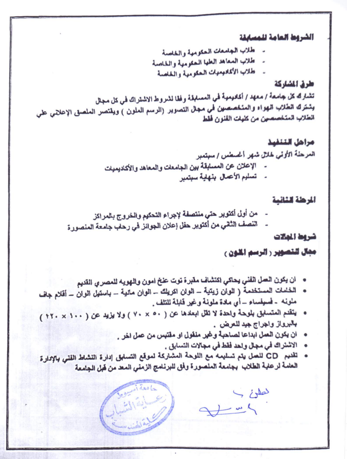
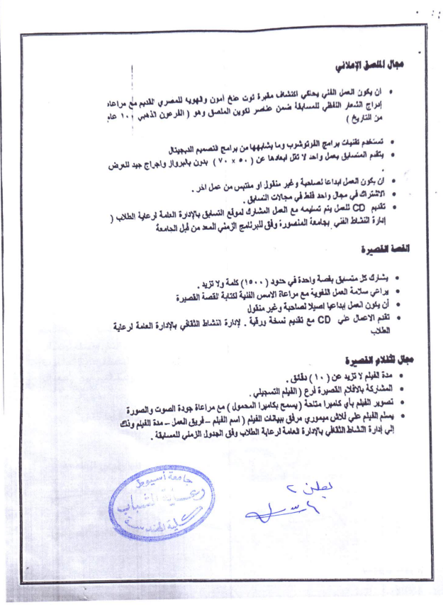
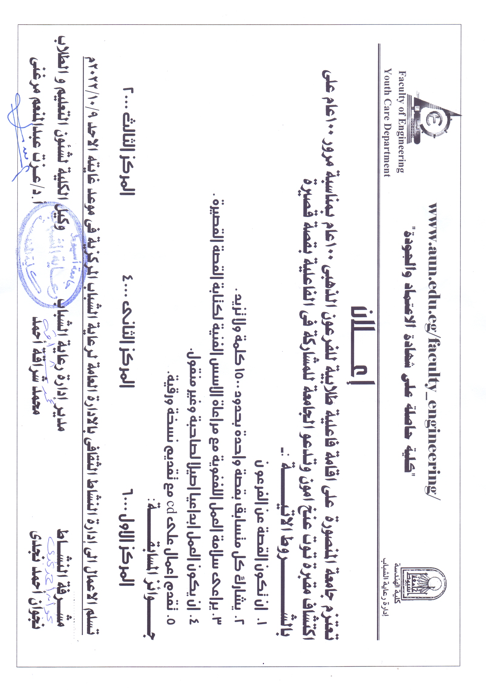
Student event "The Golden Pharaoh - 100 Years of History" Read more about Student event "The Golden Pharaoh - 100 Years of History" 11 September 2022
An invitation to Assiut University students to attend a symposium on climate change and its impact on the poor Read more about An invitation to Assiut University students to attend a symposium on climate change and its impact on the poor 11 September 2022
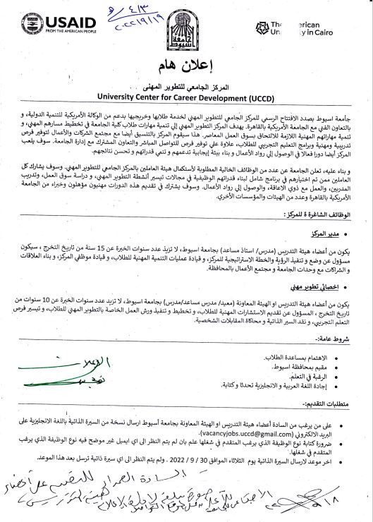
University Center for career Development Read more about University Center for career Development 20 September 2022
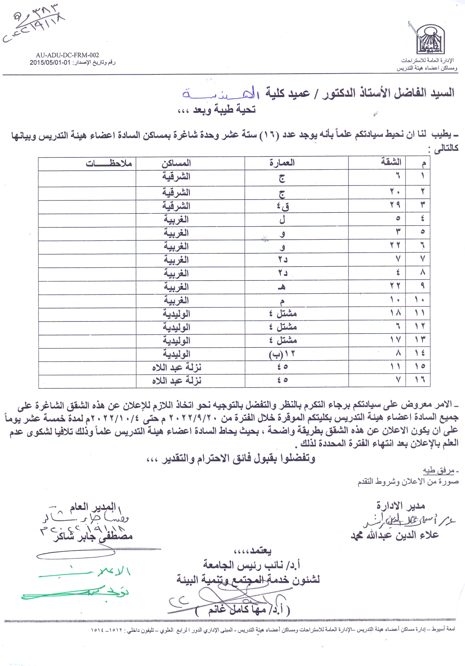
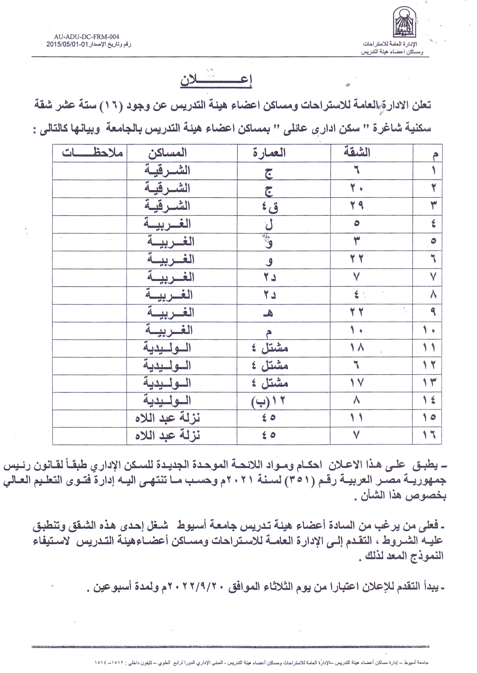
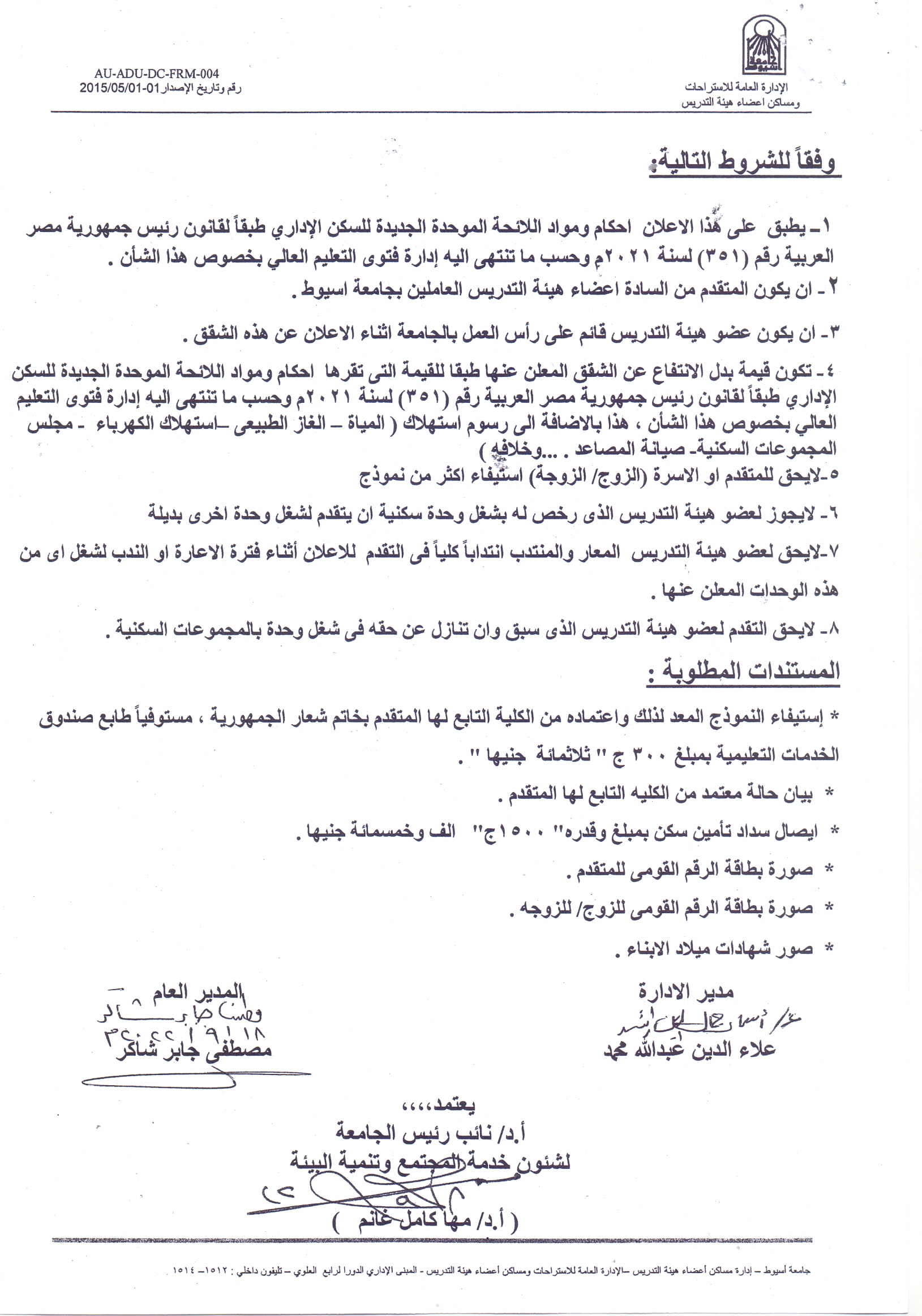
Vacant units in the residences of the faculty members Read more about Vacant units in the residences of the faculty members 20 September 2022
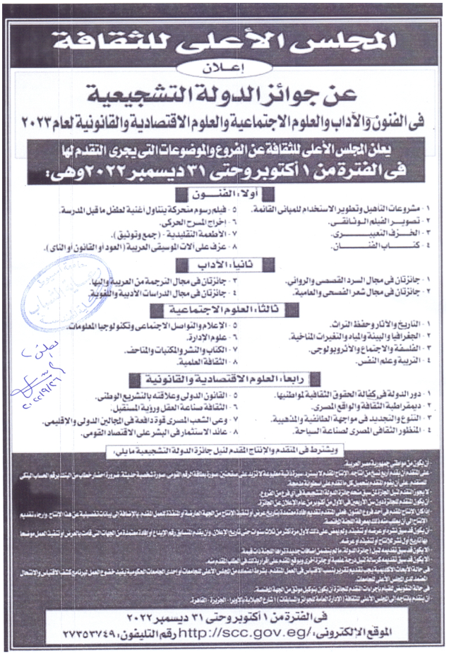
State Incentive Awards in Arts, Letters, Social Sciences, Economic and Legal Sciences for the year 2023 Read more about State Incentive Awards in Arts, Letters, Social Sciences, Economic and Legal Sciences for the year 2023 26 September 2022
Holding an event for the students of the Golden Pharaoh Read more about Holding an event for the students of the Golden Pharaoh 22 September 2022