Practical Launch... Beginning of Practical Exams for the Surveying, Mapping, and Geographic Information Systems Program
Written by: Dr. Hind Hassanein
Under the auspices of Professor Dr. Ahmed El-Menshawy, University President, Professor Dr. Ahmed Abdel-Moalei, Vice President for Education and Student Affairs, Professor Dr. Magdy Alwan, Dean of the Faculty of Arts, and Professor Dr. Mohamed Abu Rahab, Vice Dean for Education and Student Affairs.
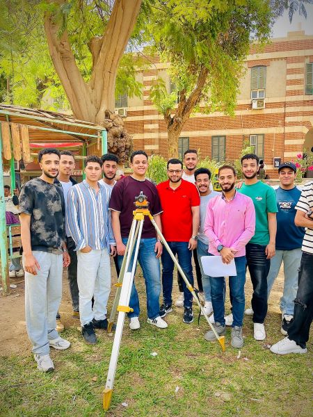
The practical exams for the Surveying, Mapping, and Geographic Information Systems program have started in the program’s specialized laboratories, with the presence of faculty members and teaching assistants supervising the exams.
The practical exams include tests in subjects such as field surveying, map drawing, Geographic Information Systems (GIS) applications, remote sensing, and spatial data processing, where students demonstrate their skills in using modern devices and specialized software.
Dr. Khaled Badra, the program coordinator, confirmed that the program pays great attention to the practical and hands-on aspect, pointing out that these exams come to evaluate the students' proficiency in the technical and professional skills that qualify them for the labor market in the fields of surveying, cartography, and geographic information systems. For their part, the students expressed their good preparedness for the exams, affirming that continuous training throughout the semester helped them gain confidence in handling modern devices and equipment used in the field. It should be noted that the Surveying, Cartography, and Geographic Information Systems program is considered one of the distinguished applied programs, aiming to prepare qualified national cadres in the fields of surveying, map production, and advanced geographic information systems applications. #Faculty of Arts Media#