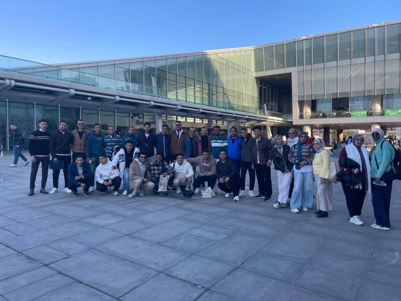
Students of the Surveying and Mapping Program at the Faculty of Arts actively participate in the activities of the “GIS Day” Conference at the Bibliotheca Alexandrina
Written by: Dr. Hind Hassanein
Under the patronage of Dr. Ahmed El-Manshawi, University President, Dr. Ahmed Abdel Mawla, Vice President for Education and Student Affairs, Dr. Magdy Alwan, Dean of the Faculty of Arts, and Dr. Mohamed Abu Rehab, Vice Dean for Education and Student Affairs, a team of students from the Surveying, Mapping, and Geographic Information Systems (GIS) program at the Faculty of Arts – Assiut University participated in the activities of the "Geographic Information Systems Day" (GIS Day) conference held at the Bibliotheca Alexandrina under the theme of "Modern Innovations in the Fields of Geographic Systems and Information," with the presence of a distinguished group of experts and researchers from Egypt and several Arab countries.
This participation comes within the framework of the faculty's support for enabling its students to engage in scientific and professional activities and enhance their practical skills in the fields of geographic information systems and remote sensing.
During the conference, the students participated in specialized workshops organized by the conference, which addressed the latest applications of artificial intelligence in spatial analysis, the use of geographic information systems in disaster management, and sustainable urban planning. Dr. Magdy Alwan, Dean of the College, expressed his pride in the students' performance, emphasizing that "this participation embodies the college's commitment to linking academic education with practical applications, and preparing a generation capable of leading digital transformation in the fields of applied geography." It is worth noting that Geographic Information Systems Day is an annual global event celebrated in more than 80 countries, aimed at raising awareness of the importance of geospatial technologies and their pivotal role in decision-making and addressing developmental challenges.